We provide GAP HASSAS online (apkid: com.geosys.hassastarim) in order to run this application in our online Android emulator.
Description:

Run this app named GAP HASSAS using MyAndroid.
You can do it using our Android online emulator.
The Gap Precision Implementation, which was developed within the scope of the Project for Dissemination of Precision Agriculture Practices in the GAP Region carried out by the GAP RDA, has been prepared in order to raise awareness of the farmers in the GAP Region about the benefits of the "Precision Agriculture" system and the application of the system and to spread it.
Aim; the use of precision agriculture by wider masses and the dissemination of sustainable yield increase throughout the region and country.
With the Gap Precision application, farmers will be able to benefit from precision agriculture practices, which is one of the innovative agricultural practices, by using the data to be obtained through aviation and space technologies, thus increasing the efficiency in agricultural production without wasting resources such as soil and water.
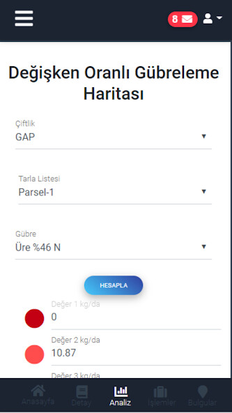
Features such as Satellite Image Analysis, Plant Development Tracking, Variable Rate Fertilization, Soil Moisture Analysis, Historical Field Comparison, Recording Individual Field Operations, Decision-Support System and Instant Access are offered in Gap Precise application.
The satellite view analysis of the field is started with the process that starts with recording the farm and field and then recording the planting process.
The user can add the irrigation, fertilization, spraying and harvesting operations performed on the field to his registered field.
He can examine his field, recorded by satellite image analysis, historically / periodically.
A problem encountered in the field can be recorded by marking the location of the registered field in the application and adding a photo if desired.
The Gap Precision application was developed in cooperation with the Southeastern Anatolia Project Regional Development Administration and TUBITAK Space Technologies Research Institute.
MyAndroid is not a downloader online for GAP HASSAS. It only allows to test online GAP HASSAS with apkid com.geosys.hassastarim. MyAndroid provides the official Google Play Store to run GAP HASSAS online.
©2024. MyAndroid. All Rights Reserved.
By OffiDocs Group OU – Registry code: 1609791 -VAT number: EE102345621.