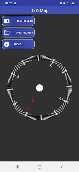
We provide Dxf2Map online (apkid: com.ancode.dxf2map) in order to run this application in our online Android emulator.
Description:

Run this app named Dxf2Map using MyAndroid.
You can do it using our Android online emulator.
Import your geolocated .dxf drawings and visualize them on top of a base map, including road map, satellite images and terrain map.
Make geolocated photo reports using the divece's camera, and export .pdf and .dxf files containing your reports, including a drawing with the location of the photos on top of the map, and a descriptive sheet containing information from each photo.
Visualice each report's photos in it's location on top of the map, or browse them in full screen.
The app allows you to read and write the geolocation, orientation and description data of the photos obtained, through the EXIF standard (Exchangeable image file format)
Sort the photographs according to the location where they were taken, or according to their age.
The reports you export will be generated in the order you have established.
You can upload photos from the device's gallery or from your cloud storage into a report and then assign the geolocation data to the photos by simply capturing location on the map through a target.
The app includes a device GPS manager, which allows:
Display the location of the device on the map.
View device location coordinates in centesimal degrees, sexagesimal degrees or UTM coordinates.
The elevation, time zone, hemisphere, precision, supplier and date of obtaining the location of the device are also shown.
Check the state of the satellites in sight (identifier, constellation, position in the sky and intensity of the received signal)
Share device location, or selected map location, by mail, social networks or cloud storage.
You can select the source datum to read the .dxf files, and the destination datum to export the reports to .dxf, from among the main datums used worldwide.
The application has support for 270 datums.
The app requires the following permissions:
Device's location access.
Device's camera access.
Read/write to external device storage.
The minimum version of the OS supported by the application is 4.1 (Jelly Bean)
To access certain functions of the application, it is necessary to watch advertising videos.
These functions are as follows:
Open a project.
Import a .dxf file.
Export a report.
MyAndroid is not a downloader online for Dxf2Map. It only allows to test online Dxf2Map with apkid com.ancode.dxf2map. MyAndroid provides the official Google Play Store to run Dxf2Map online.
©2024. MyAndroid. All Rights Reserved.
By OffiDocs Group OU – Registry code: 1609791 -VAT number: EE102345621.