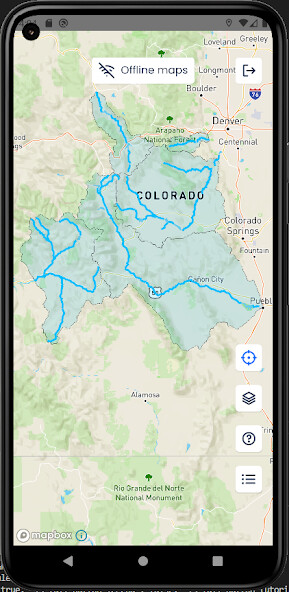
We provide Access Point Maps online (apkid: com.accesspoint) in order to run this application in our online Android emulator.
Description:

Run this app named Access Point Maps using MyAndroid.
You can do it using our Android online emulator.
Access Point Maps is a GPS-enabled app that solves the complex problem of finding publicly-accessible rivers and streams for flyfishing.
The solution is a simple and intuitive interface that shows publicly accessible land (in green) and private land (in red) along flyfishing rivers and streams.
Where the public has lease access to private land for flyfishing, that access is shown too (in purple), along with easy places to park and find the river.
Whether you are new to the sport, or new to an area, this app shows you where you can go so that you can confidently explore new rivers and streams.
The current coverage area is limited to rivers near the Front Range of Colorado, but additional work is underway, and more coverage areas will be added soon.
MyAndroid is not a downloader online for Access Point Maps. It only allows to test online Access Point Maps with apkid com.accesspoint. MyAndroid provides the official Google Play Store to run Access Point Maps online.
©2024. MyAndroid. All Rights Reserved.
By OffiDocs Group OU – Registry code: 1609791 -VAT number: EE102345621.